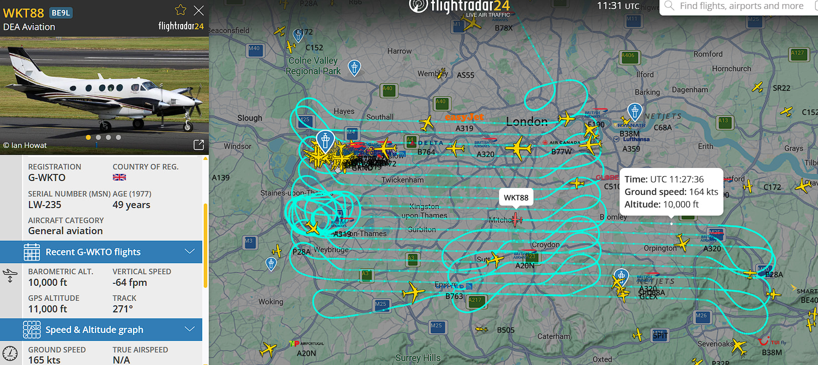
This aircraft is currently flying this pattern at circa 10,000 feet over our heads today.
In the past this pattern has been attributed to the likes of Google and other online maps orgs grabbing high-resolution images who use them to enhance their “zoom” capabilities from genuine sateliite imagery down to ground level.
Hope every one has their garden in good tidy order.