Forest Hill Station 1839 -1882

A little summary of some of the history I’ve collated about the early years. it is hard to imagine a level crossing where the subway now is, but it was definitely there.

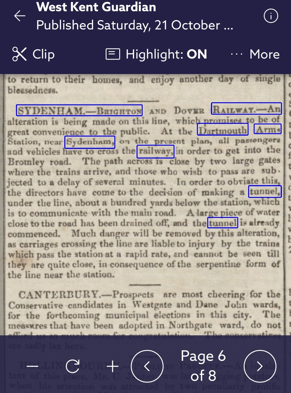
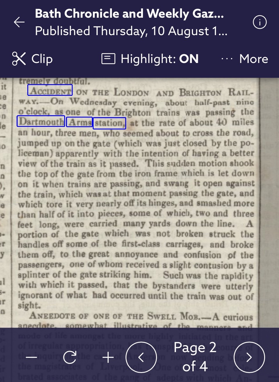
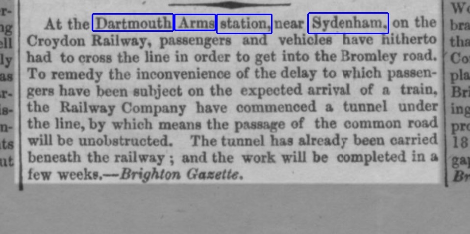
The station, then called Dartmouth Arms, opened with the line in 1839. There were two lines, one up and one down. They were along the lines nearest to present day Perry Vale. The new railway cut across the road joining London Road and Perry Vale(then known as the Bromley Road). This proved very inconvenient. Every time a train passed two gates were closed by a policeman to hold back traffic, in those days horse and carriage and I suppose horse drawn carts and trade vehicles

When years later the railway company eventually decided to put another two lines in, they built out to the west, towards London Road.

Only 4 years after opening, In 1843 the railway company decided they wanted to do away with the level crossing, which had been the subject of at least one accident. See the descriptions of the gates and the 1843 accident in newspaper articles below. They decided to tunnel under the railway to create a new route. They built a tunnel ( now the site of the Walrus mural) and road. The road was narrow, and much later they widened it added two new tracks and also raised the track bed substantially, I think in order to allow trams to use the route. we think of it as a bridge these days, not a tunnel. I’m not yet sure in what order or at what dates they did these things but I have a couple of rail magazines that explain much of it.

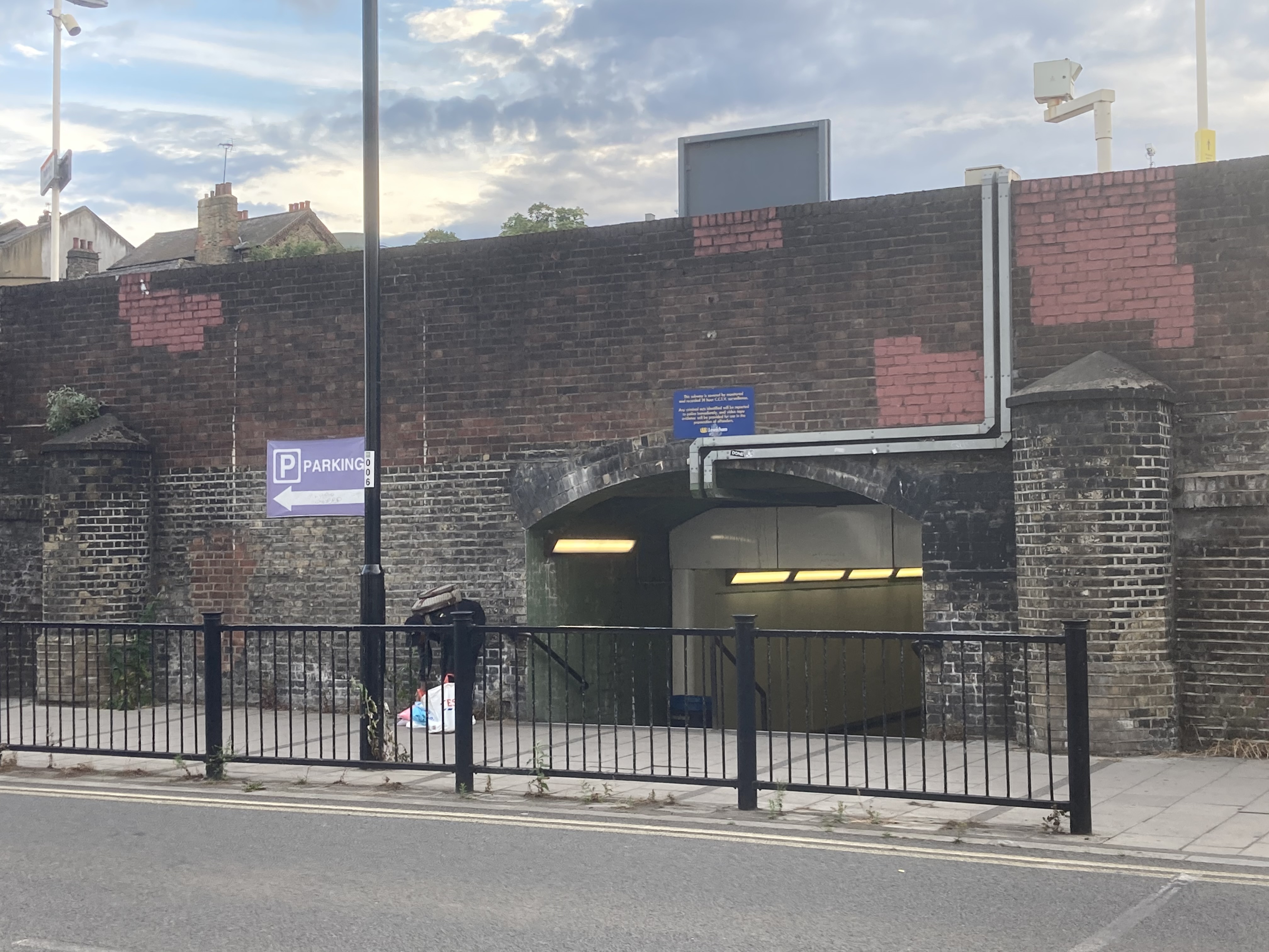
I suggest that on the Perry Vale side we can see the original station wall, with two brick pillars marking the original road across the railway. It seems likely that a gate was attached to one of these pillars. The railway was much lower then. Years later, when the track bed was raised, they would have built the wall upwards to match the new platform levels.

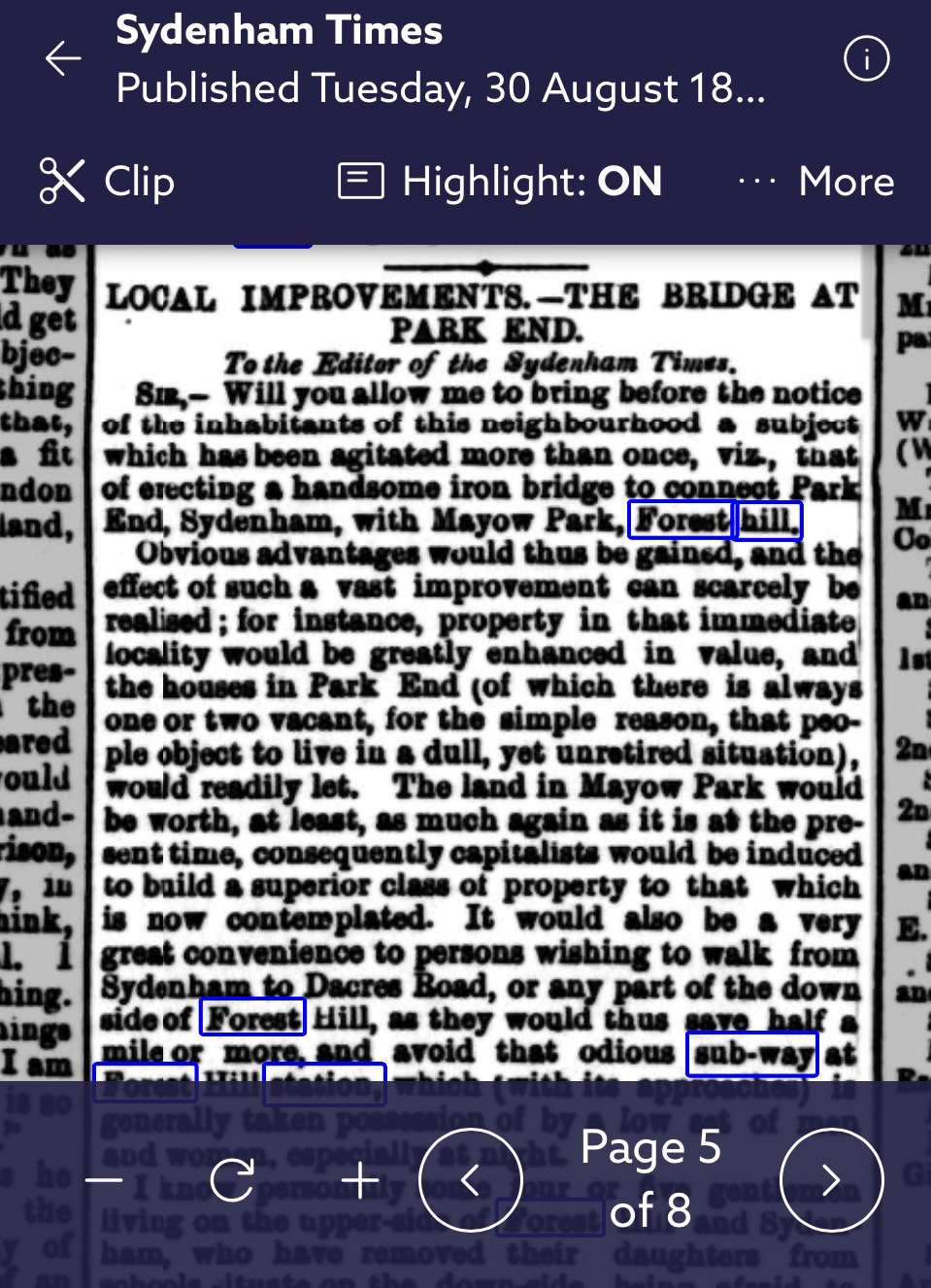
The first mention of the pedestrian subway I have found so far is in 1870. In a letter to the papers a local resident argues for a pedestrian bridge between Sydenham Park and Mayow Park, which would avoid the subway, described as ‘odious”.

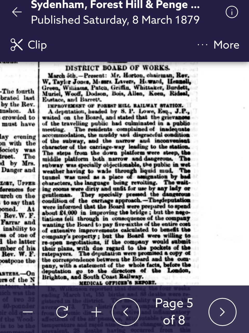
By 1879 a series of public meetings were held to complain about the state of the station, its carriage approaches, the subway which was muddy, unlit, and often a gathering point of local ‘bad characters’.

The works would have to be negotiated between the railway company and the Board of Works for Lewisham. These two bodies did not seem to get along. It was in 1882 that the railway company eventually addressed the subway. But instead of just improving the footway which was step free, although with a gradient, they eventually installed steps which we have to this day. This was against significant public opinion, and the Board of Works insisted they had never agreed it, going so far as to seek an injunction to stop this.
I’ll be interested to know if anyone else has info about this period.
11 Likes

This is fantastic information, I had no idea about the story behind what we know as the bridge and the subway which was the level crossing. I can imagine how busy it’d be with pedestrians waiting on either side.

2 Likes

in passing I have a clipping from a local resident letter in 1878 referring to the road under the railway bridge as Dartmouth Park Road. at that time it had been widely discussed that FH was to have a new station and at the same time the road under the bridge would be widened from its original too narrow state.

3 Likes

There is a building adjacent to Platform 1 which was built as a Furniture Repository. The building is next to where the lift is located. If you look through the railings at the main door next to platform, you’ll see it is some 4ft lower than the current platform height. So I guess that’s the amount the track was lifted. There’s signs of the track being lifted at various points both north and south of the station. I can tell you where if you are interested.

3 Likes

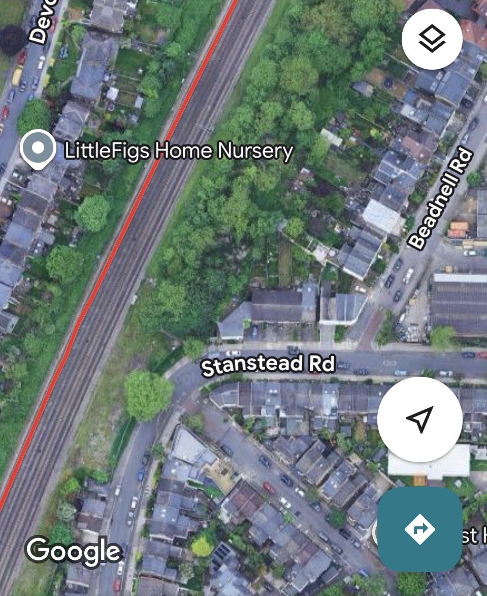
Yes I think the furniture depository is the clearest evidence I know of the track lifting. And I’ve read elsewhere that 4 ft was the change. I speculate that there is evidence to be seen in Stanstead Road of two different track bed levels. And yes v interested to know where you have noticed other signs of that change.

1 Like

If you go south of the station and look at the car park and industrial estate. When I was much younger there was no industrial estate and the car park was very long. I happen to live near the south end of that area. There is a small patch of land (currently overgrown) which I cleared 25 years ago. I found remnants of concrete laid in lines spaced railway width apart. I presume they were the bases of the tracks/buffers. I believe the car park was lifted to conform to the raised railway height but this small section for some reason wasn’t lifted. Of course in those days it wasn’t a car park but a goods/coal yard. Further down behind a row or garages and ends of gardens the height is raised by engineering brick walls. If this was original (and before there were any houses) there would have been just a slope but I guess property lines must have been drawn along the original layout and when the track was raised it needed a retaining wall.

4 Likes

That’s excellent - someone, I suspect it was you posted about this on the Sydenham Town forum. I went down to that bit of land, behind Vale Lodge, and saw what you refer to- it was cleared a couple of years ago but is hugely overgrown again now.

Since I wrote the first post on this thread, I’ve seen a reference by Steve Grindlay that the original subway dates to 1843. Since he was so meticulous this must be true, so it looks as though when they built Canal Road and the tunnel under the railway in 1843 they also replaced the dangerous and inconvenient pedestrian and carriage road crossing with the sloped pedestrian subway under the track.

1 Like

Everything points to the level crossing being right opposite London Road. I read somewhere that it was a dangerous slope down to it from London Road. So I guess that fits with the track being roughly level with Perry Vale at that time.

The land was totally cleared of all trees, at least 11 from memory (unfortunately none had TPO on them). The land has been left since then but the owners are applying for planning permission to build on it. The owners are the same ones building where the garages used to be on the other side of Vale Lodge.