Waldram Park Road

I’m interested about this road as I live on it, and so I thought I would try to document some of its history.

Today, Waldram Park Road is the short stretch on the South Circular (A205) between the crossing at the start of Perry Vale (where the Co-op used to be), to the junction with Sunderland Avenue. Theoretically, an unremarkable stretch of urban road space.

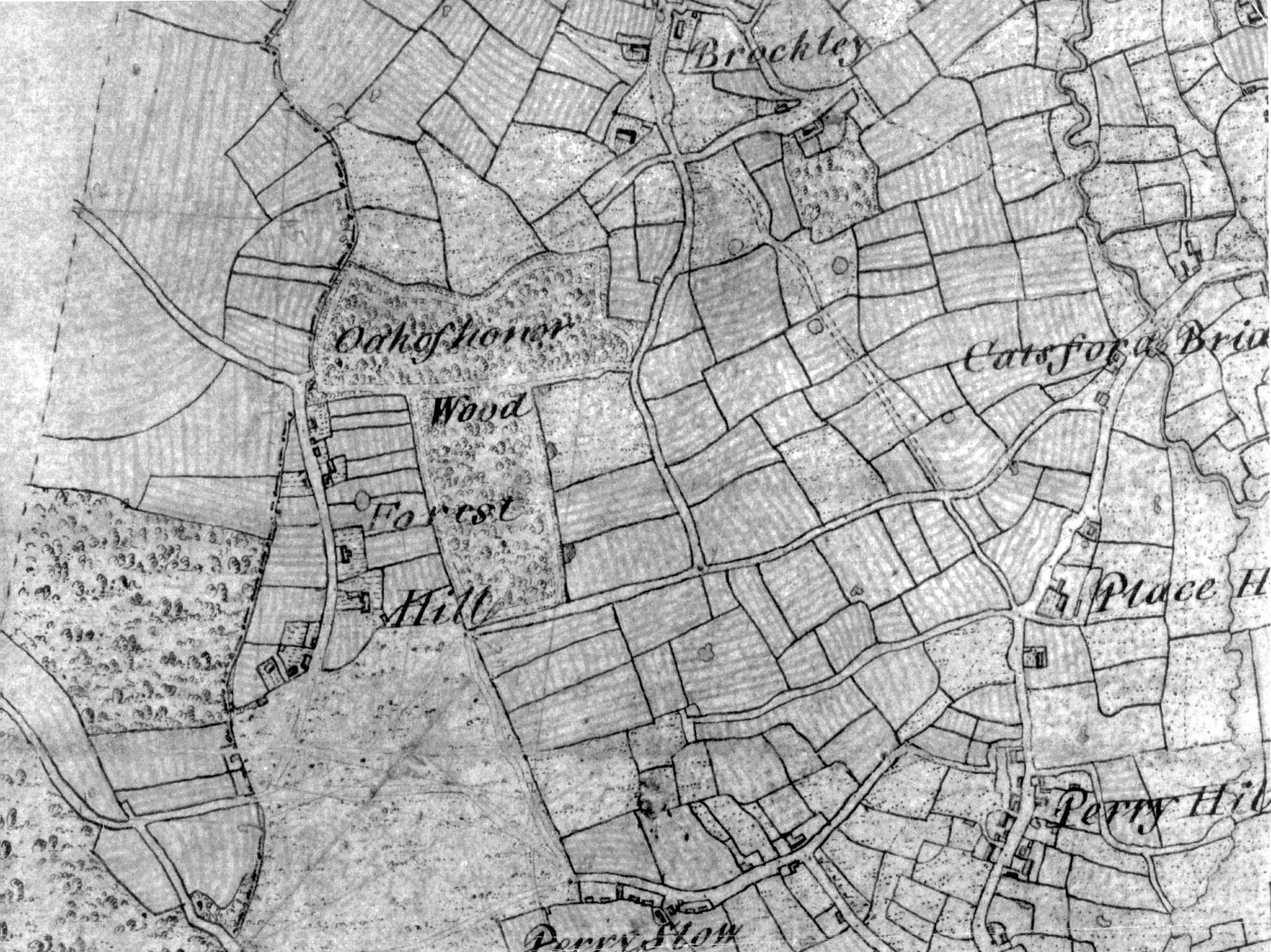
The earliest cartographical evidence for the road’s origins are in this 1799 Ordnance Survey map, showing a route (now Stanstead Road) from Catford towards Forest Hill. I believe it ends about where the modern Stanstead, Sunderland and Waldram Park Roads converge, but you can see some tracing of the paths used that match current roads, and connect with the other road further West, which is probably the modern Honor Oak Park Road (and the original “Forest Hill”)

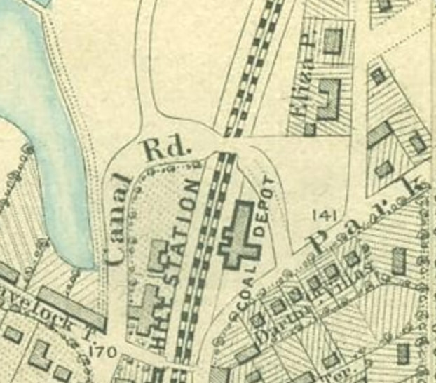
By the around 1850, the area had been partially built, with most of our modern roads, but with different names. In our case, this was called simply “Park Road”. Take a look at this detail from the fabulous Stanford’s Library Map of London and Its Suburbs (from the mid 1800s)

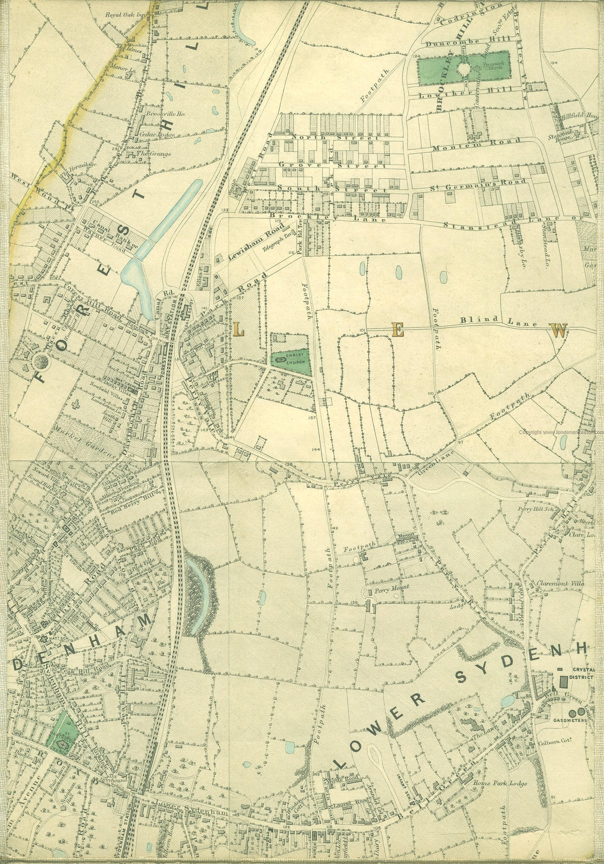
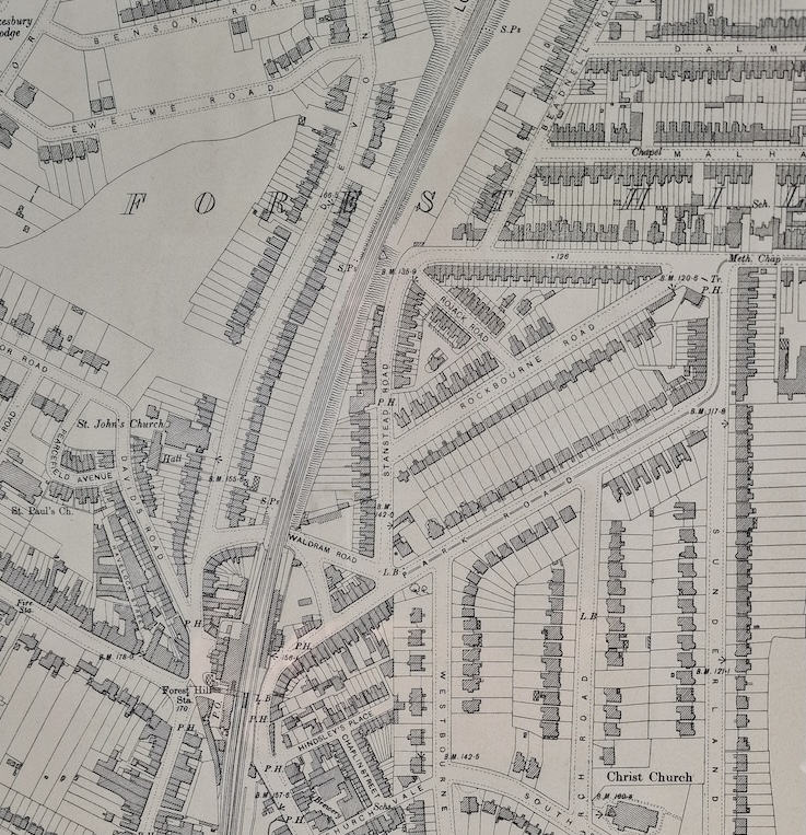
It was called Park Road for a long time while the buildings on this stretch of road, but also all around the area, were going up. Here’s a further detail from the Ordnance Survey map of 1894-1896. You can see some of the roads have been renamed (e.g. Lewisham Road becomes Rockbourne Road, Brockley Lane becomes Stanstead Road

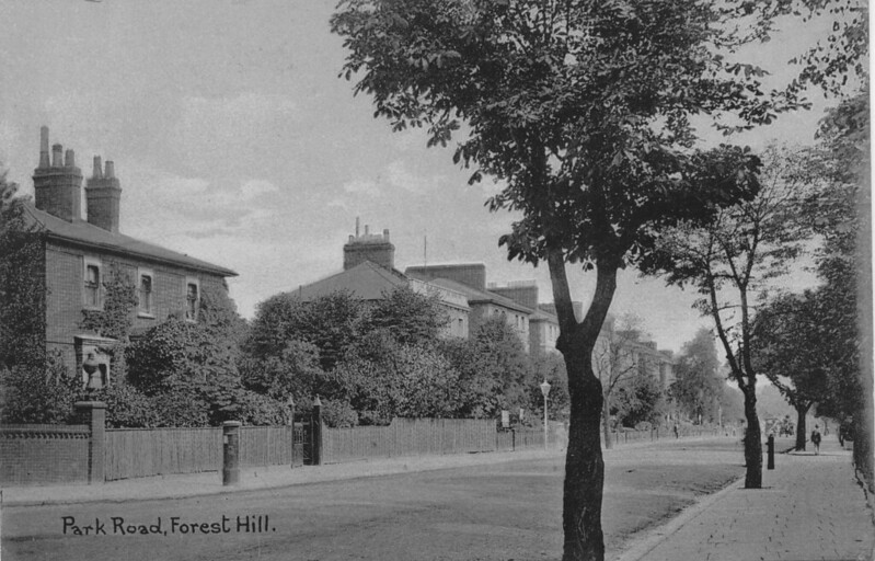
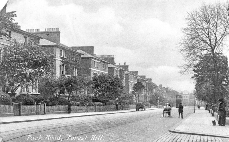
Around this time, this was a really beautiful place, as seen in some of these photos from around 1900 (all courtesy of Steve Grindlay’s amazing archive of photos on Flickr)

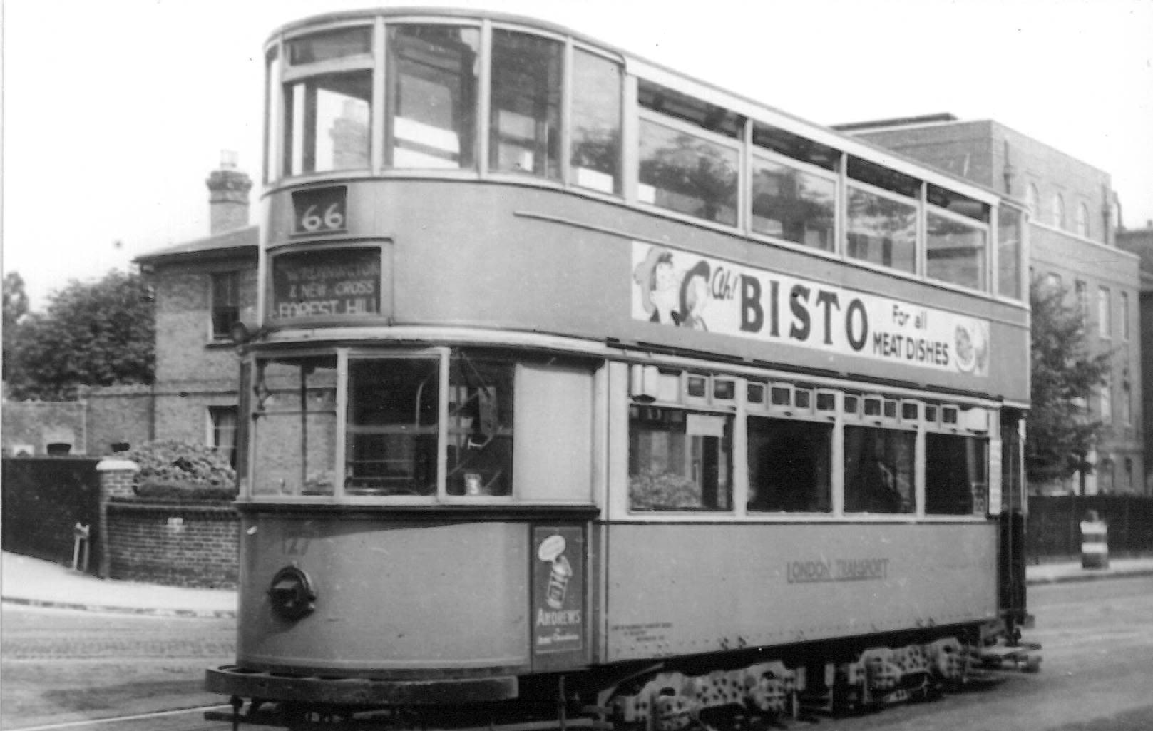
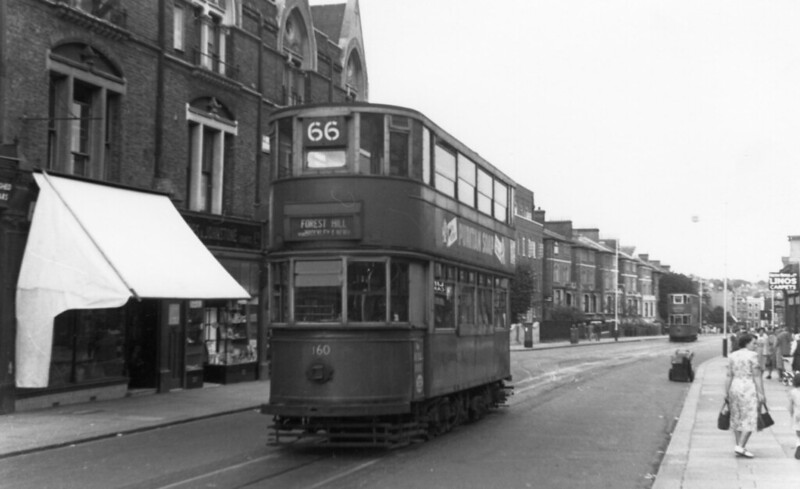
And here it is, stretching out beyond Perry Vale, the terminus of the trams that used to come along these roads, in the 1950s

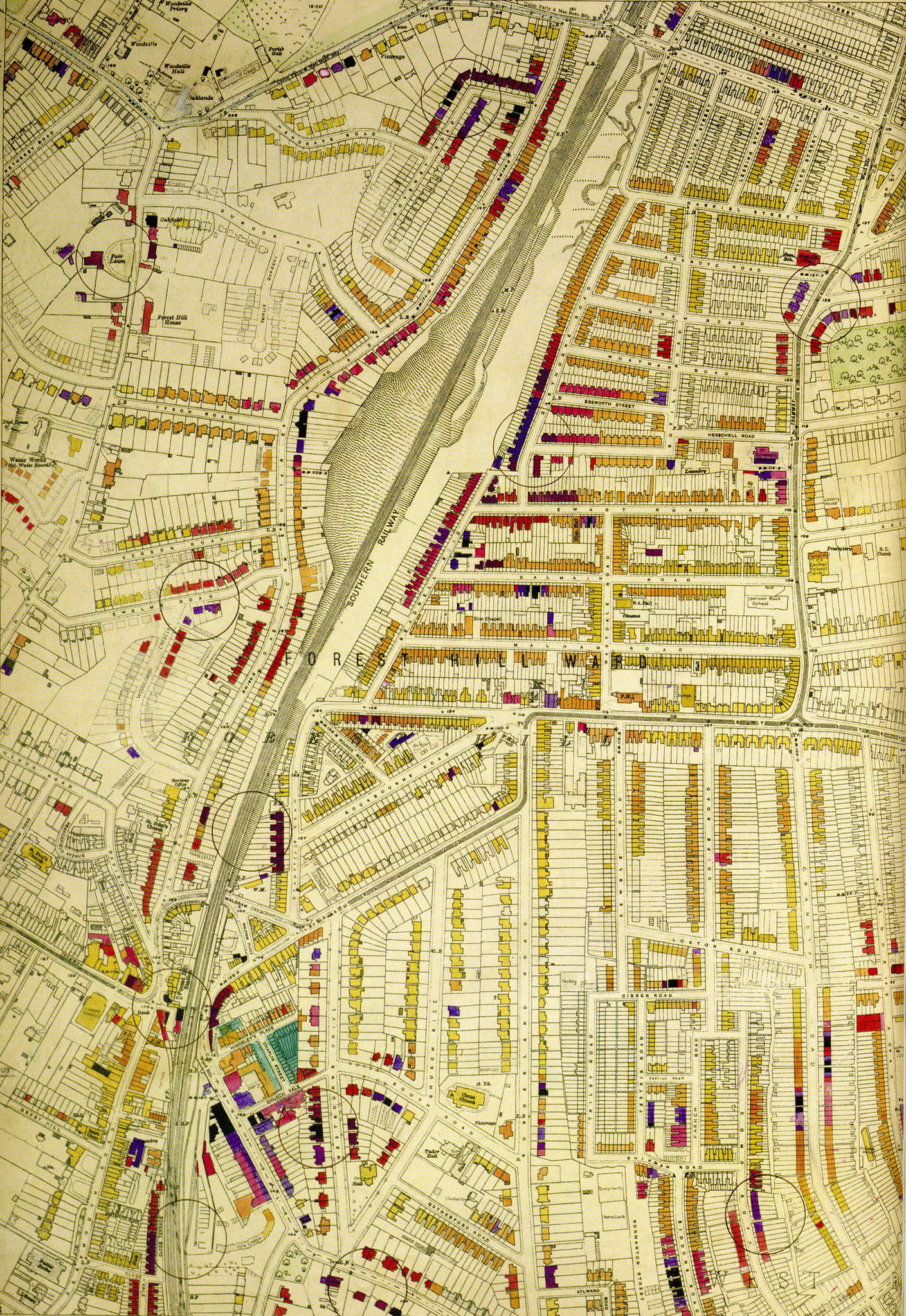
Now, I’ve not been able to find out exactly when Park Road became Waldram Park Road. I have seen OS maps from 1946 calling it Park Road. However, other maps, including the London County Council bomb damage map below already have it as Waldram Park Road.

There was a wave of street renaming in 1912, so it may have happened around then (there were already far too many “Park Road” names in London at the time.

The last bit of a mystery to me, is the emergence of Montrose Way. In all recent maps this road connecting Waldram park Road to Rockbourne Road did not exist, but I’ve not been able to find out when it might have been created. It does not appear to have been a direct effect of bomb damage (as you can see from the map), so there must have been another justification at a later date. Can you help?

1 Like

Sorry Robert that I haven’t been of use just yet on this specific question. It’s a great example of exactly the type of question many of us have about the street we live in. It will be really interesting to see what possibilities are discussed if anyone ventures them. In a related way, I would like to establish how and when the name Dartmouth Park (the area radiating from Christchurch) was used to describe the area immediatedly south of Park Road (marked Pickthorns on old maps) as acquired by Lord Dartmouth presumably around the time of the enclosure of Sydenham Common. Was this why Waldron Park Road started as Park Road?

I’m pretty sure that “Park Road” was an integral part of the Dartmouth Park plan / branding as it would have made this the main thoroughfare from Catford to FH and made it more prestigious to have a larger house here (I guess). However, I’ve never seen proper plans for Dartmouth Park, only references, so digging that out would be very interesting.

On a related note, back in 1850 the section which is now Waldram Place / Devonshire Road, was called Canal Rd (when the canal was a recent memory and the basin still existed).

What is intriguing is that the crossing of the railway was obviously OVER the rails rather than the underpass we have now. However, the Coal Depot (which I guess is now the Workshop) sits 10m or more below the level of the station. Crossing the railway must have meant descending a steep bank on the other side to Perry Vale. I can’t quite picture how that would have worked.

The name “Waldram” was already in use for the short section under the railway in 1900, and I don’t know where that came from. Having done a little research, there was an engineer called Percy John Waldram alive and working at this time (search for Waldram Method for calculating Right to Light). Intriguingly, I have found a reference to say that he was married (for the second time, and apparently to his sister-in-law!!) in “Lewisham” in 1935 (when he was 65). Could be a coincidence, but … maybe he was an engineer involved in creating the underpass / bridge?

I honestly didn’t believe for one minute that the road crossed OVER the railway, I had believed that was an anomalous cartographic oversight. But because this is an important point I shall try to stay open minded in respect of the fact that I can’t prove it (yet) or just never understood it properly in the first place.

Similarly the area of the subway is also shown as running OVER the railway, I suppose had the track bed actually been much lower in height at that time, then both road and subway could have been bridges. That thought had not occurred to me. There was after all a swing bridge on the canal, so either side of today’s railway might have been more level than today.

Because this covers both the earliest part of the railway and the history of the canal, I’ll hold back from these points until after I’ve done more background reading. By that time we should have separate topics for the canal and the railway.

You must be right. The Perry Vale side of the station must always have been lower (the canal ran along a contour line which was along Havelock and then well West of Devonshire, so the ground would have sloped from there.

In fact, I remembered that there are some stairs that gave access to the station platform from under the bridge (now covered in weeds) so these must have been created with the original station design. They only lead to the pavement on that side which is higher than the road as this was extended in later years to allow trams to pass under (IIRC).

Photo by Steve Grindlay

Also, the underpass must have been fairly early on as it gave access to the station’s central platforms that were installed with the Atmospheric Railway (more of that in future).

The only conundrum is that there was a swing bridge over the canal which I was told would be roughly where the underpass entrance by TG Jones is today. In that case, the other side must also have been raised at that level, which it is clearly not today

As a follow-up of probably minor or tangential value, here is the proof of the (very quiet?) marriage details that show that Percy Waldram did, in fact, have a connection with Lewisham around the time that the road was renamed (though this Church was either in Lewisham or Downham, so not Forest Hill directly).

Excellent stuff Robert, this is a thing of beauty. The right to light. Wow.

Just wow.

I was browsing some older photos of Forest Hill, and there are some historic photos of the trams. Interestingly, one or two feature bits of “Park Road / Waldram Park Road”. In particular they show the large house that used to stand on the corner of Waldram Park Road / Perry Vale / Stanstead Road which eventually became a petrol station (no photos), then the local Co-op and is now an empty lot.

Unfortunately the image is copyrighted, so i can’t post it here, but you can click this link to see the house behind the tram. You can also see the original elements of the Telephone Exchange before it was extended.

You can see it in this photo as well, from the Bexhill Museum archive (linked in another topic by @DruidsPlace )

1 Like